County officials will prioritize removing sediments from critical points in the Yahara Lakes and River this summer, in an effort to move more water through the chain of lakes faster and reduce the impact of future flooding.
The multi-year dredging project will happen in several stages at six locations and cost roughly $2 million, according to Analiese Eicher, a Dane County Board of Supervisors vice chair. The first round of dredging will take place between Lake Monona and Lake Waubesa.
“One of the things that was identified is that we need to be able to move water quickly through our chain of lakes and by removing the sediment strategically, we are actually able to increase the flow from one lake to another.” Eicher said. “It was something we could do well, and have the resources to do right away.”
As the Yahara Watershed confronts another flood season, it is still reeling from the impacts of last year’s, which wrecked more that $154 million in damages county-wide. Now, the County Board is looking to last year’s floods to prepare for the future.
In addition to dredging, the board has also prioritized pumping, aquatic plant harvesting, lake level evaluation, improved dam management and run-off retention as flood management solutions, based on recommendations from a Lakes Level Task Force that met throughout the spring.
“Based on the recommendations, we are starting to take some action,” Eicher said. “We don’t want what happened last year to happen this year.”
The task force formed in response to a technical report commissioned by Dane County to assess future flood risks and outline adaptation and mitigation strategies, following last summer’s floods. The working group behind the report was composed of city and UW-Madison engineers and water resources managers.
The report was released in February, and its authors met with the task force several times throughout the spring to discuss their findings.
Key among their results was that, contrary to earlier proposals, lowering lake levels may not in fact be the best way to lessen flooding impacts.
The report investigated several different adaptation and mitigation strategies — including lake level manipulation — but ultimately it found that the most successful way to prevent flooding was by moving more water out of the Yahara system, faster.
“The adaptation scenarios of lowering Lake Mendota provided little benefit to flooding,” the report said. “The mitigation scenarios of dredging and pumping produced the best results for lowering flood levels, especially when used in combination.”

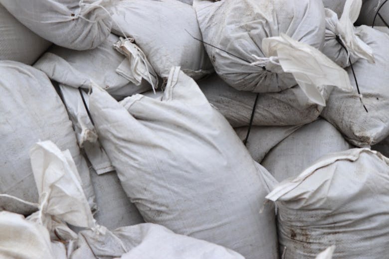
Sandbags have been piled by Tenney Park since the summer. The county hopes lessons from last year's floods will help it prepare for the future.
The report also investigated how bridge modification, maintaining Lake Mendota at a safe level, and removing dams would have changed the outcome of the 2018 floods.
The task force took flow into account in the recommendations it released to the county, and underscored the need for responsible dredging and pump installation in its list of short-term solutions.
While the task force recommended the city make attempts to keep water levels as close to their possible safe range as possible during the 2019 season, it also suggested that the DNR re-evaluate its 1979 levels in the context of the increased rainfall the area is expected to receive as climate changes.
Earlier, former Mayor Paul Soglin had called for a one-foot decrease in Lake Mendota, implying that the extra space could be used to store more floodwater.
In all, the original models predicted clearing debris by dredging and expediting flow by pumping could have lowered last summer's flood levels anywhere between seven and 21 inches. Meanwhile, lake level lowering may only have accounted for a two-inch flood level decrease.
The report went on to caution that lowering Mendota may actually pose consequences to lakes downstream, since such a change would cause its water levels would rise above its summer maximum more often. As a result, the lower lakes would see more fluctuations in lake levels, with the Tenney Dam being used to quickly release water instead of buffering water levels further down the chain.
Lowering Lake Mendota by an entire foot would have negative environmental impacts too. The resulting water level fluctuations could damage wetland habitats and impact state threatened species, such as the Sheathed Pondweed, White Lady’s Slipper and Tufted Bulrush, which currently grow in the lake.
Maintaining steady flow tested as a more effective option, since water movement through the chain of lakes is currently impacted by several flow limitations in the rivers, according to the report.
Examples of those obstructions included narrow bridges and sediment deposits.
“Debris in the river, such as tree trunks and boulders, causes friction and slows water flow. Aquatic plants also cause friction and reduce water flow,” the report said. “The flows through the lower lakes are limiting efficient release of water and are still prone to flooding.”
While managing flow may be critical to controlling floods, the report emphasized that flooding can be prevented on the land too — before stormwater has even entered the lakes.
Preventative measures, like containing stormwater on land and limiting development in wetlands, could be one solution, the report said.
“We’re thinking, what can we do for the community to provide a tool that’s going to help us answer questions in the future?” said report co-author John Riemer, at a February task force meeting. “How can we use these tools to help address flooding?”


